AI-driven rule extraction
Zoning regulations and municipal ordinances parsed into clean, machine-readable development rules.
Turn any plot into an instant, visual, investment-ready feasibility study — before committing time, capital, or design resources.
Feasable combines AI-driven rule extraction, automated data collection, parametric modelling, and financial insight — so the true potential of any plot is clear from day one.
Zoning regulations and municipal ordinances parsed into clean, machine-readable development rules.
Cadastral parcels, building permits, geospatial layers and urban constraints — pulled and aligned automatically.
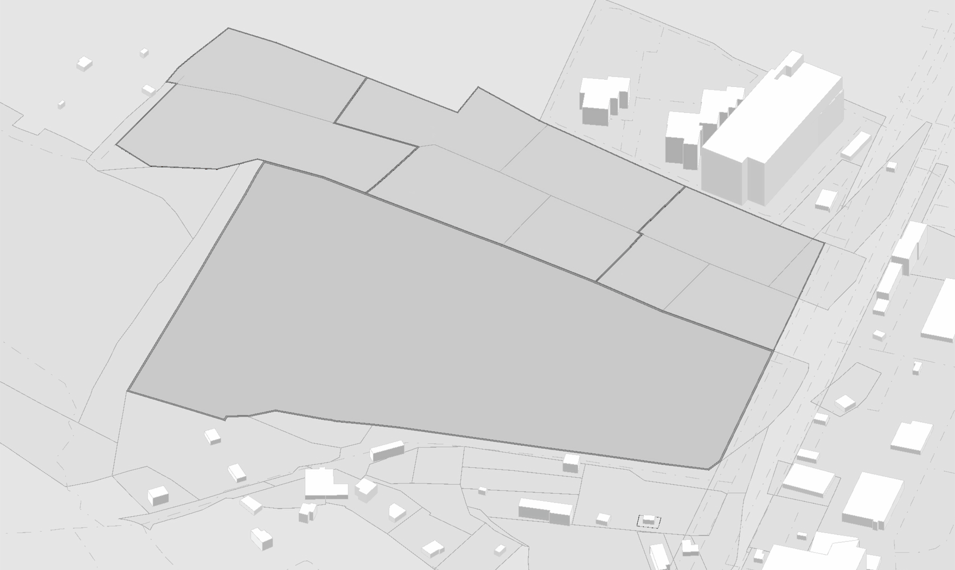
Compliant development scenarios generated in 3D — instantly responsive to setbacks, height limits and density, made by experienced architects.
FAR, density, height limits and buildable area — computed and traceable to the rule that drives them.
Translate potential into the numbers investors commit capital around — fully automated financial modeling.
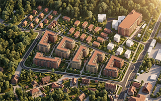
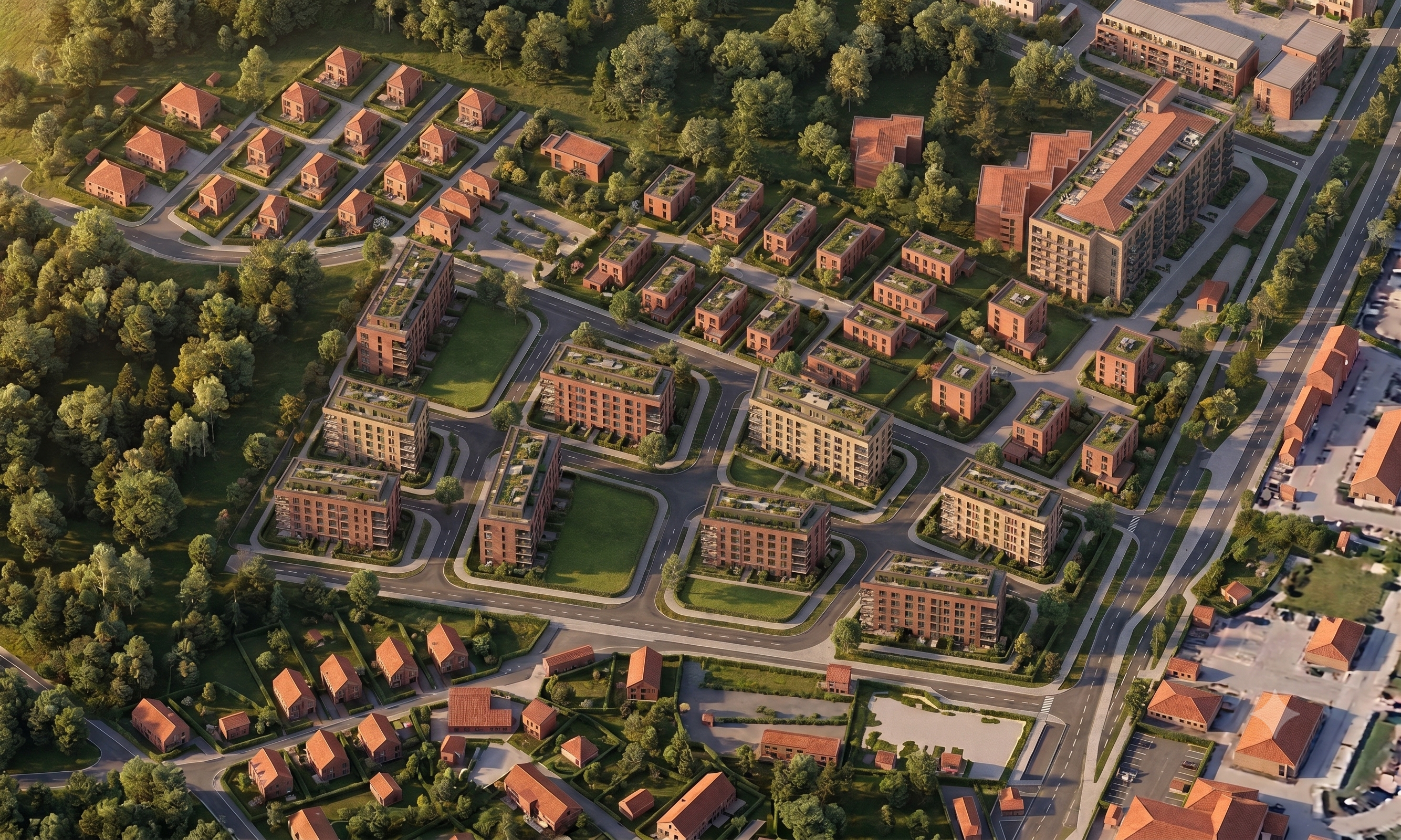
Turn the compliant 3D massing into a realistic visualization of the finished development — a shared image everyone can align around.
Pick any parcel on the map, anywhere.
Zoning, cadastre & constraints, gathered.
Compliant 3D scenarios, in seconds.
Parameters & financial insight, together.
An AI photorealistic visualization.
A clear, structured project presentation.
The 3D massing model becomes an AI-generated photorealistic visualization — the common language that aligns investors, architects, municipalities and stakeholders around the same picture.
Test what a site can become and de-risk decisions before committing capital or design fees.
See buildable potential and financial upside in a structured, comparable, defensible format.
Turn a listing into a visual, data-backed story of what could be built on the land.
Start from compliant massing and parameters — and spend your time on the design that matters.
Feasable is building the intelligence layer for early-stage real estate development.
We transform fragmented zoning regulations, cadastral data, geospatial information, urban constraints, and design logic into instant, visual, and investment-ready feasibility studies. By combining AI-driven rule extraction, automated data collection, parametric 3D modelling, and financial insight, Feasable allows developers, investors, brokers, and architects to understand the true potential of any plot before committing time, capital, or design resources.
Our platform turns the first uncertain weeks of a real estate project into a structured, transparent, and data-driven workflow — from map selection to compliant massing options, key development parameters, construction potential, and shareable project presentations.
Feasable combines professional expertise of architects, financial and legal experts and amplifies it with AI and code, accelerating decision-making, and creating value for investors and stakeholders.
Our mission is to accelerate and de-risk real estate development by transforming fragmented regulations, geospatial data, and design constraints into instant, actionable, and professionally structured feasibility intelligence.
We help investors and development teams make faster, better-informed decisions by combining architectural expertise, AI, parametric modelling, and investment analysis in one integrated platform.
Our vision is to become the global copilot for urban feasibility and real estate development. We aim to create a single digital workspace where any user can select a plot, understand its regulatory and investment potential, generate compliant 3D development scenarios, compare alternatives, and present a project clearly — anywhere in the world, in any regulatory context, within minutes.
Feasable's long-term ambition is to become the standard infrastructure for early-stage real estate decision-making: the platform where development potential is discovered, tested, optimized, and communicated before capital is committed.
Be among the first teams to turn the uncertain first weeks of a project into a structured, transparent, data-driven workflow.